Image scaled down
See full-size image.
See full-size image.
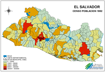
Based on data from the Census of Population of 1992 San Salvador is more densely populated reporting 1.706 inhabitants by km2 in 1992, however in 1971 it reported 828 inhabitants by km2. The second department more populated is the La Libertad with 311 inhabitants by km2, these data reflecting the migration of the population, specially in the period during the armed conflict.
