- World ::
- North America ::
- Quebec
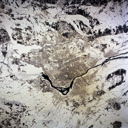
Satellite Image, Photo of Montreal, Quebec
See full-size image (4.15MB).
From: NASA
Montreal, Quebec, Canada February 1994. The snow covering helps accentuate several major features of metropolitan Montreal, Canada's second largest city with slightly more than 3 000 000 people. The Saint Lawrence River stands out as it flows northeast through the south and northeast parts of the city. Most of the darker areas scattered randomly throughout the photograph are forests. The main part of the city is located on two islands-Montreal Island (the larger and southern island) and Jesus Island (north of Montreal Island). The downtown area is located north of the Saint Lawrence Seaway near the center of Montreal Island. The oval shape north of the central business district is Mount Royal Park. Runways of the two major airports-Dorval (Montreal) International, west of downtown, and Mirabel International, located approximately 26 miles (40 kilometers) northwest of downtown-are distinguishable by their long, angular runways.
