- World ::
- North America ::
- Quebec
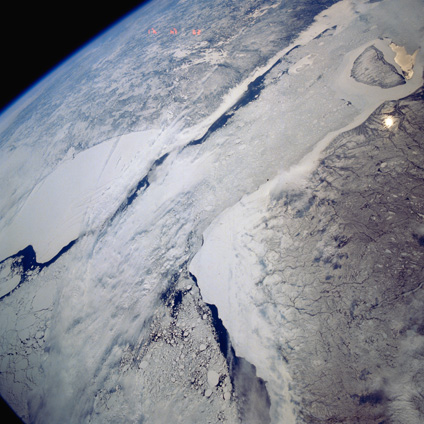
Satellite Image, Photo of Hudson, James Bays, Quebec
See full-size image (2.08MB).
From: NASA
Hudson, James Bays, Canada May 1991. The southern end of Hudson Bay (lower left) and its southern extension James Bay (upper right), are visible in this southeast-looking view. Cloud cover partially obscures the different sized ice floes that can be found mainly in the south central section of Hudson Bay. The large, white, smooth-looking features east and west of the water are probably snow covered ice that are adjacent to the shorelines of Quebec (top) and Ontario (bottom). The dark areas within Hudson and James Bays show the extent of open water in spring (May). Akimiski Island is the island near the western side of James Bay (upper right corner).
