- World ::
- North America ::
- Quebec
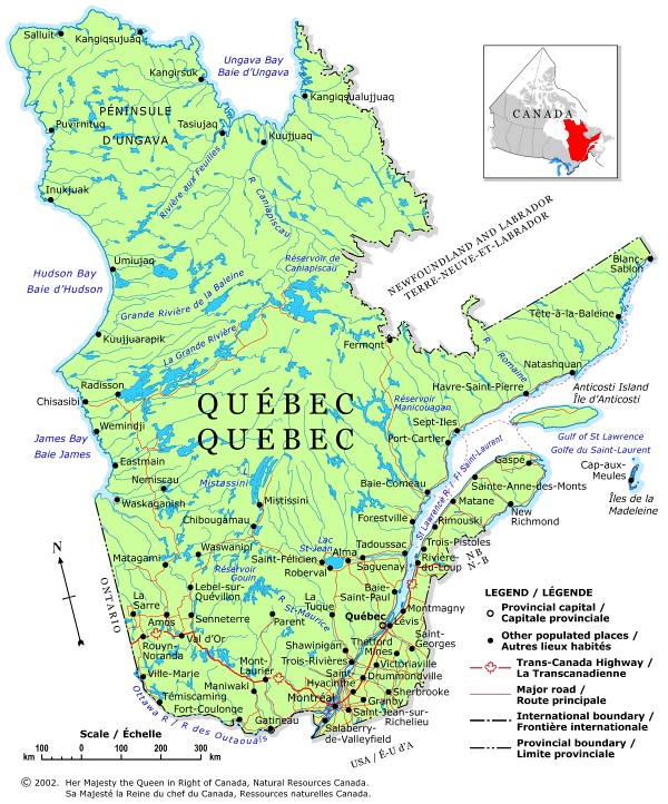
Quebec Political Map 2002

This map is from the Atlas of Canada © 2006. It has been reproduced under license from Her Majesty the Queen in Right of Canada with permission from Natural Resources Canada.
A political map of Quebec showing boundaries, the provincial capital, selected populated places with names, selected drainage with names and selected roads.